About the takeaway
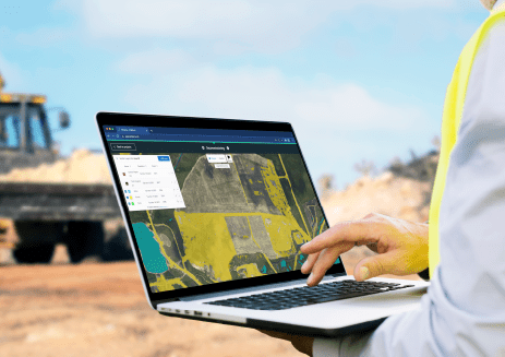
Validate and analyze land plots using satellite, drone, and aerial imagery.
Simplify compliance with EUDR and other regulations, verify carbon credits, and streamline sustainability efforts – all within a modular, API-ready product.
Download our takeaway on Picterra Tracer to discover more:
- Ensure data quality
- Creation of plot boundaries
- Advanced geospatial analysis
- Modular API for tailored workflows
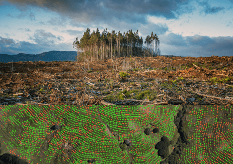
You'll learn about Picterra Tracer's streamlined and efficient workflow and the types of advanced geospatial analysis that can be performed:
- Monitor deforestation with precision
- Streamline carbon credit verification
- Enhance biodiversity assessments

.png)