About this webinar
Forests are key to our climate change response. Yet the process of taking care of them remains remarkably manual.
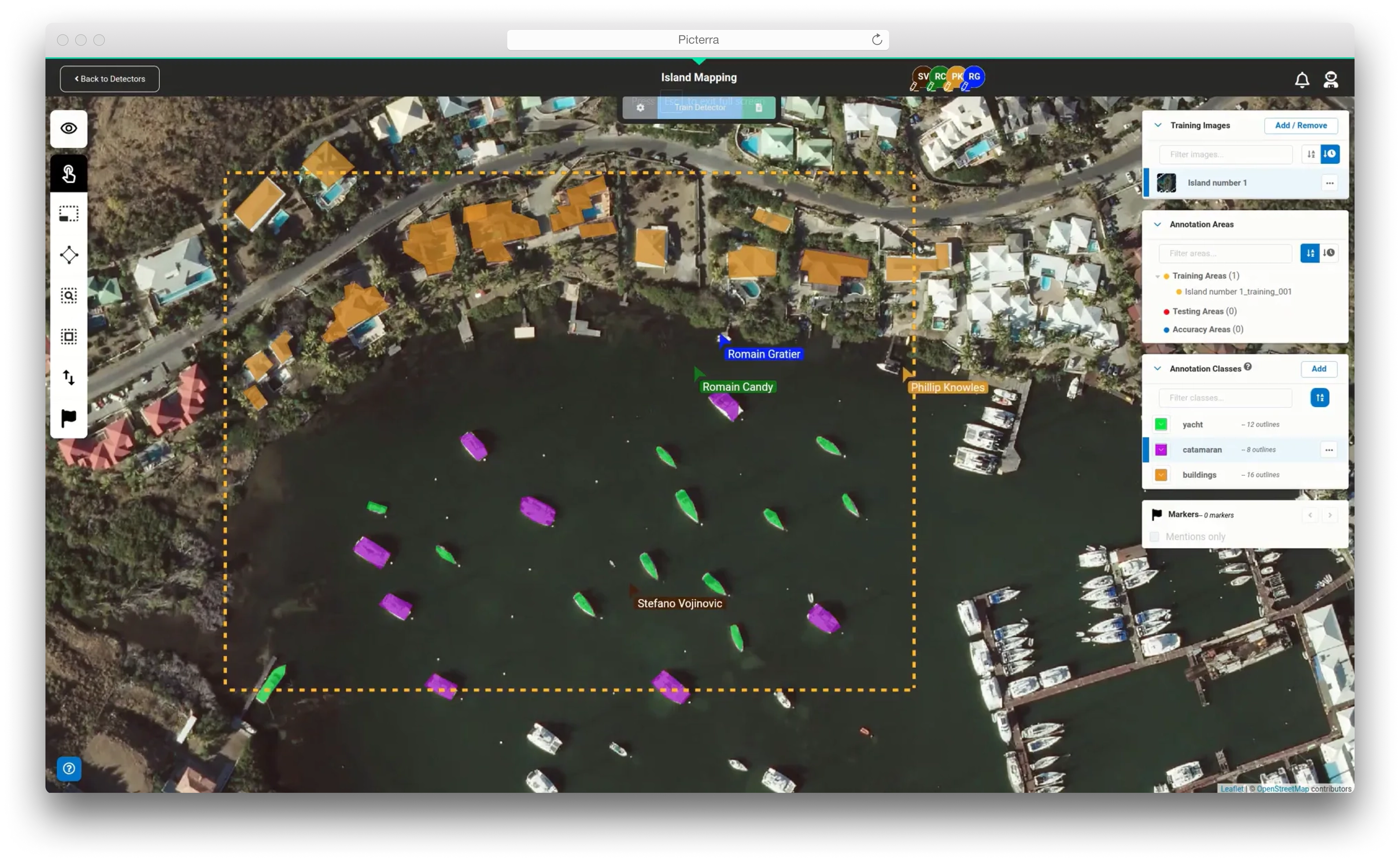
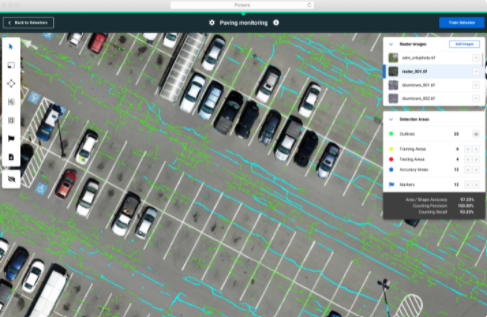
Best case, you’re counting trees and monitoring vegetation health in drone images. Worst case, everything is done in the field. Both techniques get the job done, but the costs and time involved make them impossible to scale.
That is where geospatial technology can help.
In this on-demand webinar, we review how best-in-class rangers and vegetation control professionals use remote monitoring and geospatial software to:
- Scale operations efficiently by automating key aspects of vegetation management
- Reduce cost by moving from cyclical to condition-based maintenance
- Increase accuracy and repeatability of health measurements
Register today to hear Joy Bhansingh, Account Executive at Picterra, and Andy Carroll, CTO at Skytec discuss how geospatial technology improves the future of the world’s forests.